
Large areas of the German North Sea lie in the Wadden Sea and are exposed to the influence of tides and storm surges. To ensure the safety of seafaring traffic and the protection of the coastal areas among other things, up to date high-resolution geodata is required. This data includes digital surface and terrain models, digital imagery and a variety of 3D line geometry such as water-land-boundaries or 3D structural lines.
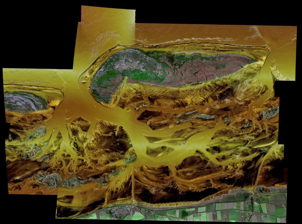
Due to the changing water levels and weather conditions, the time window for data acquisition is extremely shallow. The use of airborne SAR (Synthetic Aperture Radar) makes it possible to stretch this window, as it is possible to acquire data even with closed cloud coverage and it is able to cover a up to five times bigger area then state of the art ALS scanners.
As part of the GeoWAM[1] project, we try to develop a new solution to harness the advantages of SAR imaging. Project partners include:
- German Federal Institute for Hydrology (BfG)
- Lowe Saxony State Agency for Water Management, Coastal and Nature Conservation
- German Aerospace Center (DLR)
- Karlsruhe Institute for Technology
- Disy Informationssysteme GmbH
The Institute for Photogrammetry focuses on the analysis of the image data provided by the DLR to extract 3D structures for different purposes:
- Monitoring of coastal protection buildings like dikes, reclamation areas and groynes
- Monitoring of movement within the mudflat
Press
Publications:
Bolz, T.; , Schmitz, S.; Thiele A., Soergel, U. & Hinz, S. [2020]
Analysis of Airborne SAR and InSAR Data for Coastal Monitoring. 40. Wissenschaftlich-Technische Jahrestagung der DGPF in Stuttgart – Publikationen der DGPF, Band 29, 2020, pp. 457-461.
URL: https://www.dgpf.de/src/tagung/jt2020/proceedings/proceedings/papers/65_DGPF_2020_Bolz_et_al.pdf
[1] www.geowam.net (German)

Uwe Sörgel
Prof. Dr.-Ing.Director of the Institute