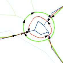
Along with the increasing power of Geographical Information Systems (GIS) there is an increasing demand for spatial data. National and private institutions collect spatial data in different data models and scales in order to meet this demand. Additionally, huge amounts of spatial data are collected in Web 2.0 mapping portals. The result is a multiple representation of the same topographic objects of the landscape. The aim of this research is to investigate the integration of such datasets by using conflation techniques. Conflation is a kind of spatial data processing that combines multiple layers of spatial data into one common layer.
References
Walter, V. & Fritsch, D. [1999]
'Matching Spatial Data Sets: a Statistical Approach', International Journal of Geographical Information Science 13(5), 445–473.
Volz, S. & Walter, V. [2006]
Linking Different Geospatial Databases by Explicit Relations. Geoinformation Science Journal, Vol. 6, No. 1, 41-49.
Chen, H., Walter, V. [2010]
Hierarchical Quality Inspection of Spatial Data by Data Integration. ASPRS 2010 Annual Conference, San Diego, California (on CD-ROM).

Volker Walter
Dr.-Ing.Head of Research Group Geoinformatics


