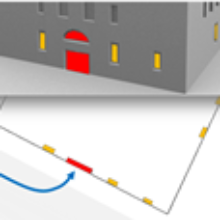
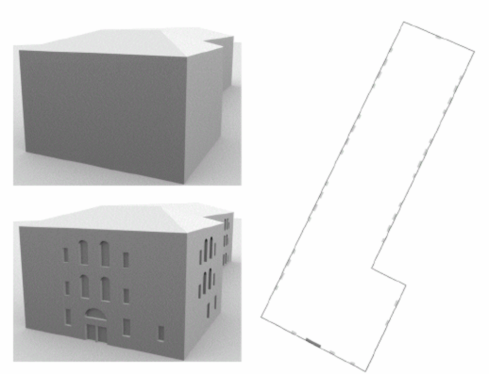
In order to provide a geometric basis for spatial world models for context aware applications, methods for the automatic derivation of 3D building structures from sensor data with heterogeneous quality have been developed. Resulting 3D building models can be used for various scenarios. Strategies have been worked out to make the 3D building structures applicable in navigation systems for blind people. Based on façade models in which detailed façade structures are represented by explicit 3D geometry and semantic information, 2D maps can be derived for each floor where windows and doors are described by annotated polygons.
Especially the position of doors may be helpful for blind people when searching for the entrance of a building. Figure 1 (left) shows the Central Administrative Building of the University of Stuttgart as 3D model before and after façade reconstruction. The corresponding 2D map of the ground floor is given in Figure 1 (right) where façade elements are marked as filled polygons. Beside pedestrian navigation, a number of other applications can take advantage of semantically interpreted 3D building models. For example, detailed façade models allow for energetic estimates of a building's heat loss by calculating the ratio of wall to window areas. Furthermore, they are appropriate to complement Building Information Models which are used for facility design, construction and asset management. Façade structures can also be used to simulate high-resolutionSAR images in order to support Persistent Scatterer Interferometry (PSI) focused on single urban objects. However, most applications require not only geometric and semantic knowledge but also quality information about the building structures. Therefore, application dependent quality criteria for façades have been developed which are appropriate to be used in various scenarios. Such evaluation criteria consider the ratio of void to solid of a façade, the form and size of windows as well as their arrangement.
References
Schmitz, B., Becker, S., Blessing, A. & Groβmann, M. [2011]
Acquisition and Presentation of Diverse Spatial Context Data for Blind Navigation. In: Proceedings of the 12th IEEE International Conference on Mobile Data Management (MDM 2011), pp. 276-284.
Auer, S., Balz, T., Becker, S. & Bamler, R. [2010]
3D SAR Simulation of Urban Areas Based on Detailed Building Models. Photogrammetric Engineering & Remote Sensing, Vol. 76, No. 12, pp. 1373-1384.