Nowadays, high resolution satellite image data have been commonly used for Digital Surface Model (DSM) generation and 3D reconstruction. Different to standard photogrametry, commercial satellite imagery vendors usually deliver Rational Polynomial Coefficients (RPCs) instead of ex- or interior elements to the customers. RPCs build a generalized and direct relationship between image and object coordinates. This relationship is pure mathematic and without any physical meanings. The qualities of the stereo image rectification and subsequent procedures are all depended on the accuracy of the RPCs. It is common that the RPCs’ precision is not accurate enough and it will cause bias between the calculated coordinates and the true location. Moreover, it is not easy to obtain ground control information to refine the RPCs for every dataset. Therefore, our work presents two relative orientation methods which use the corresponding image points only.
The first method is the relative additional bias-compensated model. It will generate some quasi ground control points from several tie points on images and the rough RPCs. In the next step, by using the quasi ground control information, the bias-compensated adjustment method is applied to refine the RPCs. The second method estimates relative pointing error, which indicates the distance from the true corresponding points and epipolar curves on the matching image. We apply the affine transformation to model the relative pointing error of the whole image scene. The affine parameters are estimated by least-square methods. Both methods do not need any ground control information and are applied for entire image without tiling.
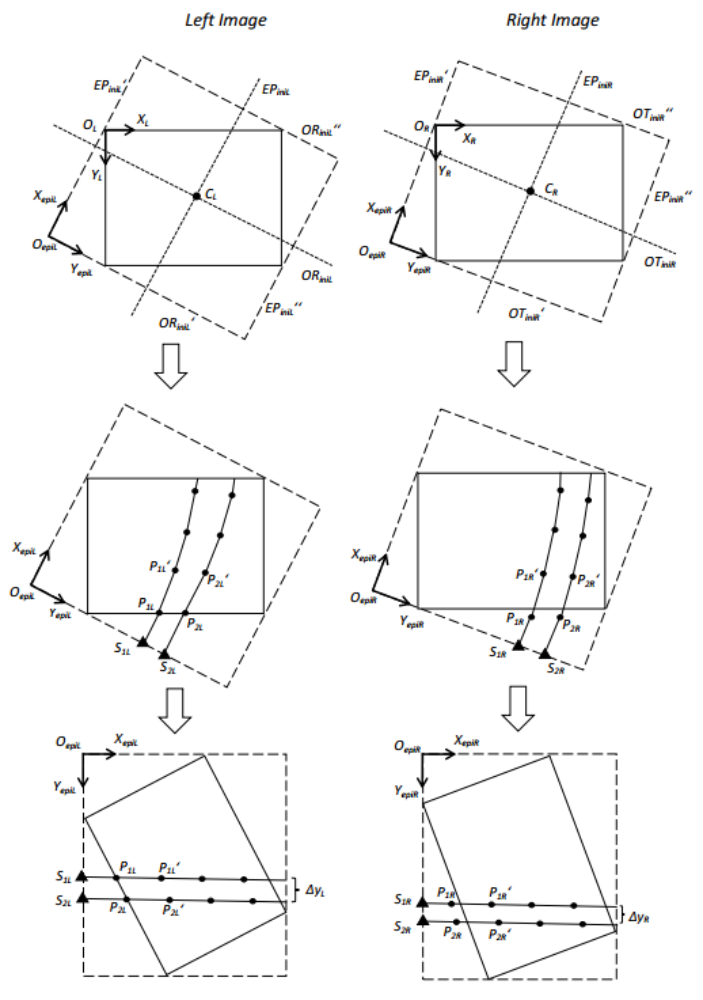
In order to get very dense point clouds, the Semi-Global Matching (SGM) method is an efficient tool. However, the epipolar constraints are required for the dense image matching. In most conditions, satellite images have very large dimensions, contrary to the epipolar geometry generation and image resampling, which is usually carried out in small tiles. We present a modified piecewise epipolar resampling method for the entire image without tiling. The first step is to define the coordinate system of the epipolar image. In Figure 1, the dot lines represent the initial epipolar line of image center point and its orthogonal line. The dash lines depict the range of the epipolar image. OL and OR are the origin points of left and right epipolar images, and the arrows show the axis. Next step is the determination the start point for the epipolar curve pair generation. We establish the starting points set along the boundary (triangle points in Figure 1) of the left image and extent the segments along the initial epipolar direction. In the case of the right image, the conjugate points of the left start points are set as the start points. Then the local epipolar curve pairs are generated by projection-trajectory method from the start points. According to the character of the satellites imagery, the local epipolar curves can be modelled as segments in small area. The epipolar curve grows to a proper length and stop, so that the epipolar curve approximation is preserved in good quality. The end point of the segment is selected as the new start point to generate the next segment until the epipolar segments are outside of the image. At last, we resample the epipolar stereo images. Every epipolar pair is aligned to the same row in epipolar image coordinate system. The stereo images are resampled along the epipolar segments.
A sample QuickBird dataset is applied to test the relative orientation methods. The GSD of QuickBird data is 70cm and covering area is Melbourne, Australia. The original RPCs of the imagery are low accuracy. Figure 2 demonstrate the results before and after the relative orientation. Finally sub-pixel accuracy has been achieved in our work.

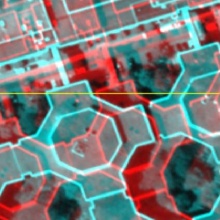
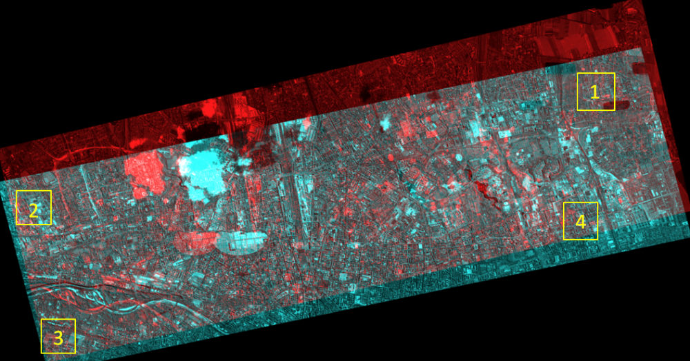
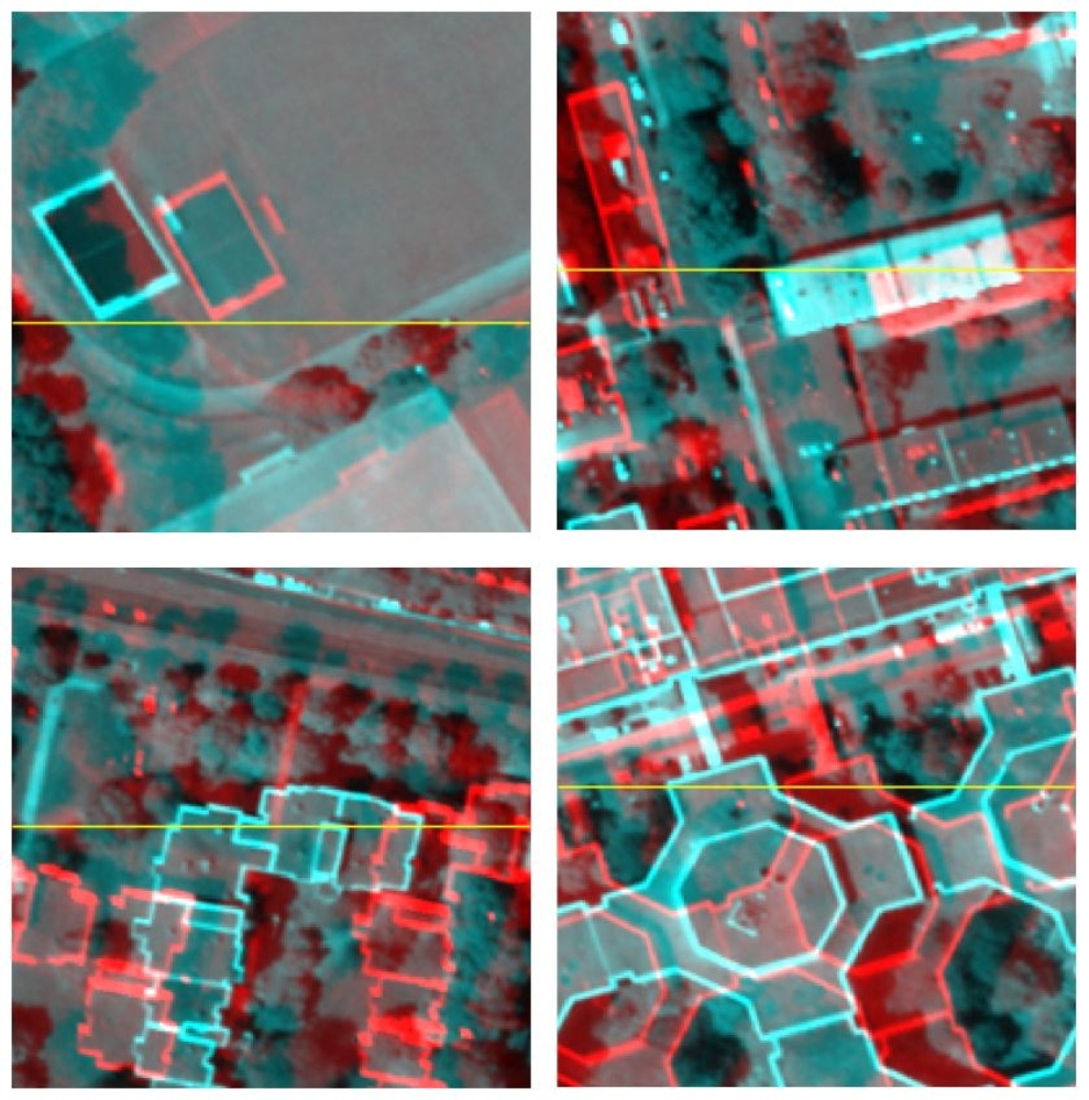
The WorldView-2 stereo imagery is selected to verify the modified piecewise epipolar resampling method. It comprises the city area of Munich, and the GSD is 0.5m. The size of the WorldView-2 stereo image pair is about 9000*24000 pixels. We generate the epipolar stereo pairs and also the anaglyph image (in Figure 3). Moreover, four areas locates at the corners of the epipolar stereo image pair are extracted. The analygph subimages in Figure 4 are applied to investigate the y-parallax over the entire image. According to Figure 4, the y-parallax of the corner areas is close to zero.
References
Gong, K. & Fritsch, D. [2017]
Relative Orientation and Modified Piecewise Epipolar Resampling for High Resolution Satellite Images. Int. Arch. Photogramm. Remote Sens. Spatial Inf. Sci., XLII-1-W1, pp. 579-586.
DOI: 10.5194/isprs-archives-XLII-1-W1-579-2017

Michael Cramer
Dr.-Ing.Head of Research Group Photogrammetric Systems