Ruwei Nie
Processing of Allied Air Forces World War II Strategic Air Reconnaissance Imagery
Duration: 6 months
Completition: September 2021
Supervisor: Dr.-Ing. Michael Cramer
Examiner: Prof. Dr.-Ing. Norbert Haala
Introduction
In this master thesis the Historical Aerial Images (HAIs) from World War II were processed to construct 3D models using Structure from Motion (SfM) method. The data sources were acquired from the Thüringen-Geoportal including the HAIs from the end of the World War II and the present-day reference orthoimages and reference Digital Surface Model (DSM). A MATLAB script was programmed to standardize the original HAIs for preprocessing. The image center coordinates and the Ground Control Points (GCPs) coordinates in the real coordinate system were determined in QGIS and applied to georeference the HAIs. Since the study area is located in Germany the real coordinates system was set to be ETRS89 / UTM zone 32N. The Structure from Motion software Agisoft Metashape was applied to implement the HAIs to generate the orthomosaic model and the 3D Digital Surface Model (DSM). The accuracy of the georeferencing error was assessed by means of root mean square error (RMSE) computation. A coarse-to-fine approach was proposed to achieve a final seamless orthorectified image mosaic and DSM with a satisfying horizontal accuracy of georeferencing at a lower cost of manual work as for a minimal number of GCPs expressed in terms of nGCPs/km2, and to search for possible methods to improve the vertical accuracy at most.
Methods
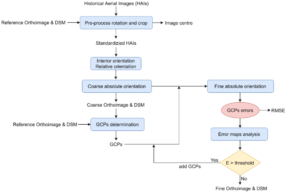
The designed workflow illustrated in Figure 1 includes three main parts: the image pre-processing, the data processing, and the result analysis. In the image pre-processing part, the original HAIs were standardized, and the image center were obtained. In the data processing part, the proposed coarse to fine approach was conducted with the GCPs determination. In the result analysis part, the GCPs coordinates error and the CPs coordinates error were assessed to be RMSE and the error values were analyzed to error map productions. The number of GCPs would be increased and added in the areas with high error values indicated by the error map to georeference the fine orthoimage.
Results
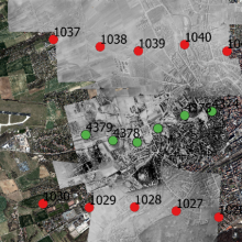
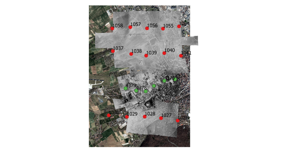
As shown in Figure 2, the spatial positions of all the 21 historical aerial images processed in this master thesis were marked in the reference orthoimage. The positions of image center of flight line 194539 and flight line 194574 were marked in green and in red, respectively. The flight directions of flight line 194539 and flight line 194574 were both west-east.
In total 4 steps of adding GCPs to improve the georeferencing results were conducted. See Figure 3. The 24 CPs maintained unchanged and provided checks and controls to the georeferencing quality. The selection of GCPs and CPs was conducted in the entire study area covered by the three image groups. The control points and check points were selected on the surfaces assumed to be stable over time.
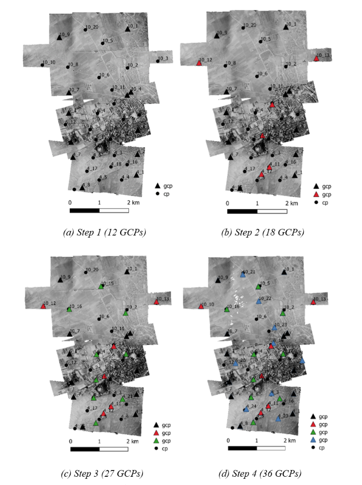

In study area in Erfurt, 2.83 m in X and 3.57 m in Y are absolutely acceptable for horizontal accuracy considering the area is 20 km2 and there were only 27 GCPs applied. The Z error with 12.53 m is, however, relatively large for vertical accuracy. The possible reasons might be the GCPs selection procedure. The GCPs were selected on the identical features such as the roof edges. It might be the fact that some of the points were located on the road besides the roof or on the tree leaves above the roof, which could make a difference of 10 m to 15 m in vertical. Increasing the number of GCPs could not improve the vertical accuracy and stopped in step 4.
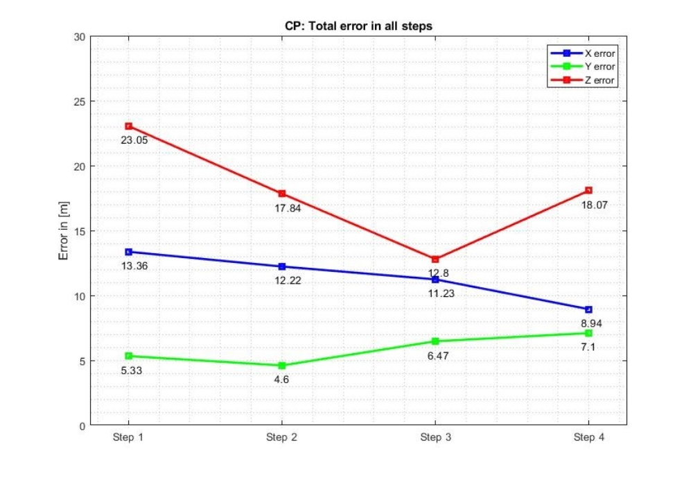
The best horizontal accuracy and vertical accuracy for test study in Thangelstedt obtained in this master project are 11.23 m for X error, 6.47 m for Y error and 12.80 m for Z error. It can be acceptable in horizontal considering the condition that the study area is in the forest area and farming fields. It was very difficult to identify the features for GCPs and CPs determination and most of the points were selected on the road intersections which are not accurate enough for horizontal accuracy. As for the vertical accuracy of 12.80 m, one possible error source is that the points were located on the tree leaves above the road intersections, but not on the road intersections, because of the manual selection, which could make a difference of 10 m to 15 m in vertical.
Conclusion
In this master thesis, the final RMSE values of horizontal and vertical accuracy of the methodology satisfy the expectations of the practical application in LBA. The workflow in this master project provides a method to georeference the historical aerial images efficiently with the index nGCPs/km2. This index might be noteworthy for the application in LBA, to reduce the manual investigation to select GCPs to georeference the historical aerial images to the present-day orthoimages or maps. The research of refining the vertical accuracy indicated how important the determination procedure of GCPs and CPs was, which provided a method of how and where to locate the position of GCPs for the practical application in LBA, to select identical features which are not direct near trees or other vegetations and are not at the exact corner of the roof edges near streets or roads. The research areas of the applications in LBA are mostly small and basically in construction activities areas, hence, in practice it might be easier to determine the position of the GCPs and to georeference the images with higher accuracy. Additionally, the application of the software Agisoft Metashape provides an automatic image process procedure, which might be of significant usage of the practical applications in LBA in the future.
Ansprechpartner

Michael Cramer
Dr.-Ing.Gruppenleiter Photogrammetrische Systeme