Lavinia - Stefania Garoiu
Theoretical and empirical investigations of oblique airborne image geometry
Duration of the Thesis: 6 months
Completion: October, 2015
Supervisor: Dr.-Ing. Michael Gruber (Microsoft Vexcel Imaging), Dr.-Ing. Michael Cramer
Examiner: Prof. Dr.-Ing. Norbert Haala
Introduction
The oblique cameras are becoming a trend in the commercial area, especially for the innovative view that they provide, which consists of buildings façades and their footprints. Most of the oblique images applications, like urban classification and 3D city modeling, building reconstruction, disaster management, urban cadaster, etc., are implying Dense Image Matching. This algorithm is requiring a high accuracy of the image orientation and therefore of the Bundle Block Adjustment. Therefore, in the frame of this work, there were conducted investigations on oblique image geometry and its influence to the later processing.
Investigations and simulations
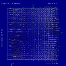
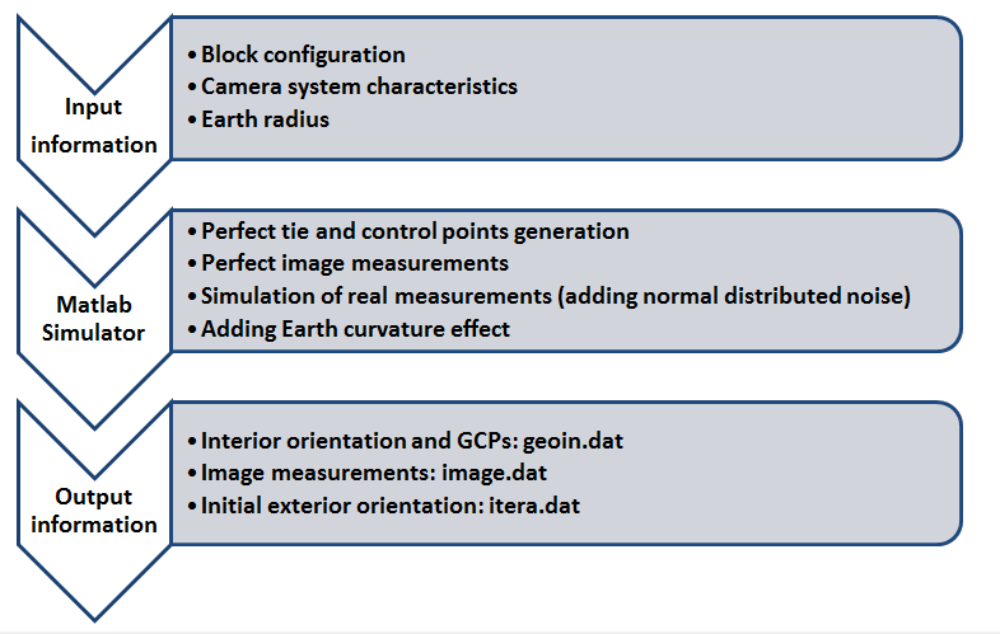
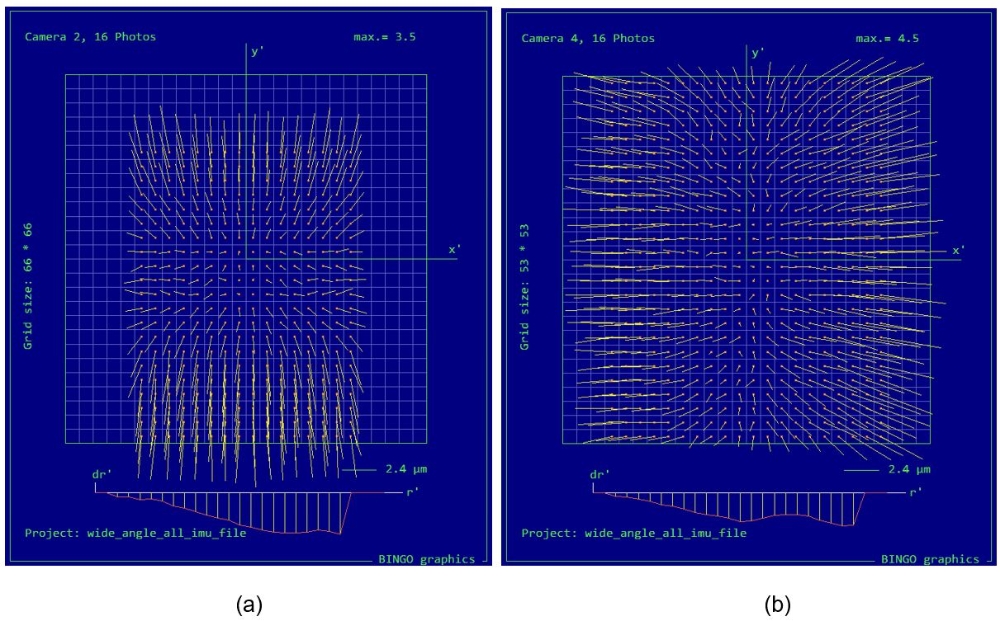
The inclination angle of the oblique camera heads is causing changes in the block geometry configuration and also it brings challenges in determining the tie points. The strong variations in image scale, the occlusions and the foreshortening effect are some of the reasons why the integration of oblique images into the Aerial Triangulation is still under development in the available software. Therefore, the influence of the oblique images onto the Bundle Block Adjustment was simulated. The simulator (Fig.1) was designed in the Matlab software, with the main purpose of ensuring the geometry extraction from the oblique images, in order to consider it into the adjustment. For all the scenarios, it was simulated that the measurements were realized with a subpixel accuracy. With the help of the simulator and by using BINGO, as bundle adjustment software, it was possible to investigate the influence of the oblique images to the Aero Triangulation results. The results accuracies were proportional to the image measurement noise, being less than 1 pixel for each scenario.
Correcting the Earth curvature effect into the oblique imagery
An important factor, which influences the adjustment results, is the Earth curvature effect.
This effect is interfering into the process due to the Reference Coordinate Systems problem. Usually a national Reference Coordinate System is not corresponding to a mathematical model. This is the case because the height is not a Cartesian coordinate, since the Z axis is following the direction of the gravity onto the Earth surface, being not always perpendicular to the XY plane. In the same time, the coordinate system used in the photogrammetric collinearity equation is a true 3D Cartesian coordinate system. Thus, the difference between the national Reference System and the photogrammetric Cartesian one can be compensated by a change of the image coordinates, represented by the Earth Curvature effect.
In order to solve this problem, the coordinates of the object points should be transformed into 3D Cartesian coordinates, or the Earth curvature effect has to be corrected.
Considering that during the processing, different software are needed, most of them being designed to use the national Reference Coordinate System, the option of using the 3D Cartesian coordinate system was not considered during this work. For this reason it was investigated how to correct the Earth curvature effect.
For correcting this effect it was not considered the classical formula, but it was modeled by using camera calibration additional parameters. By using a combination of radial and non-radial parameters it was possible to properly model this effect. This method enables an easier transmission of the used parameters to the Dense Image Matching software.
Considering the oblique camera systems main application in city modeling, scenarios with high altitude differences (like mountain regions) were not objects of investigation for this thesis. Further analysis should be done in this regards and also the influence of the atmospheric refraction should be investigated.
Conclusions
The investigations and analysis proved the utility of the oblique camera systems and in the same time, emphasized the challenges that have to be faced when working with this type of data. By simulating an oblique camera system, it was possible to investigate how the Earth curvature is influencing the oblique images. Additional parameters were introduced with the help of simulations, and they have been proved during the empirical investigations.
The use of the UltraCam Osprey Prime enabled all the investigations, by making use of a real camera system configurations implemented into the simulator and also making possible empirical analysis.
References
- Gruber, M., Walcher, W. (2013): Oblique Image Collection – Challenges and Solutions. In Photogrammetric Week ’13, Ed. D. Fritsch, Wichmann, Berlin and Offenbach, pp. 111-115.
- Haala, N. (2014): Dense image matching final report. EuroSDR Publication Series, Official Publication No. 64, pp. 115-145.
- Remondino, F., Gerke, M. (2015): Oblique Aerial Imagery – A Review. In: Photogrammetric Week ’15, Ed. D. Fritsch, Wichmann, Berlin and Offenbach, pp. 75-83.
- Rupnik, E., Nex, F., Toschi, I., Remondino, F. (2015): Aerial multi-camera systems: Accuracy and block triangulation issues. ISPRS Journal of Photogrammetry and Remote Sensing, Volume 101, March 2015, pp. 233-246.
Ansprechpartner

Michael Cramer
Dr.-Ing.Gruppenleiter Photogrammetrische Systeme