Ye Pang
Time series change detection using SAR images: From pixel-based to object-based analysis
Duration of the Thesis: 6 months
Completion: August 2017
Supervisor: Chia-Hsiang Yang
Examiner: Prof. Dr.-Ing. Uwe Sörgel
Introduction
Cities are frequently changing as a result of urban revitalization and urban expansion. Measuring and documenting these dynamic changes can facilitate a deep understanding of the changes occurring, and consequently, contribute to city management, urban planning, updating of cadastral maps, etc. (Gamba, 2013; Marin, Bovolo, and Bruzzone, 2015). Most studies related to 3D changes, such as a new stories being erected on top of a building, typically rely on a digital surface model, which unfortunately is not ideal for frequent and large-scale change monitoring due to the high acquisition costs and low temporal resolution. As an alternative, Yang et al. (2016) have proposed a 4D change detection technique to identify big change points (3D) related to disappearing and emerging buildings, along with their occurrence times (1D) using multi-temporal SAR images. However, the analysis of the pixel-based result is inefficient when investigating the construction event of single buildings because it requires going through and checking the attributes of each point from single buildings to estimate the change date. In this thesis, the big change points representing emerging and disappearing buildings are clustered spatially into single construction segments based on DBSCAN clustering. An object-based analysis is then conducted employing the statistical results relating to the temporal information of clustered points in order to provide an effective understanding of single construction events.
Methodology and Results
Figure 1 outlines the proposed methodology. The 4D change detection technique is employed to search for big change points from PS points which exist only in image subsets. The image subsets are formed by selecting a time series of break dates and the aim is to detect on which break date the changes have occurred. Since there is no external multi-temporal geospatial information to make reference to, cluster analysis was applied in this instance. The idea of α-shapes is applied for each segment to compute the boundary of the clustered points set. The boundary is then transformed from vector to scalar using Bresenham’s line algorithm for storage in the raster image. Finally, an object-based analysis is performed based on the clustered result and temporal attributes of the clustered points.
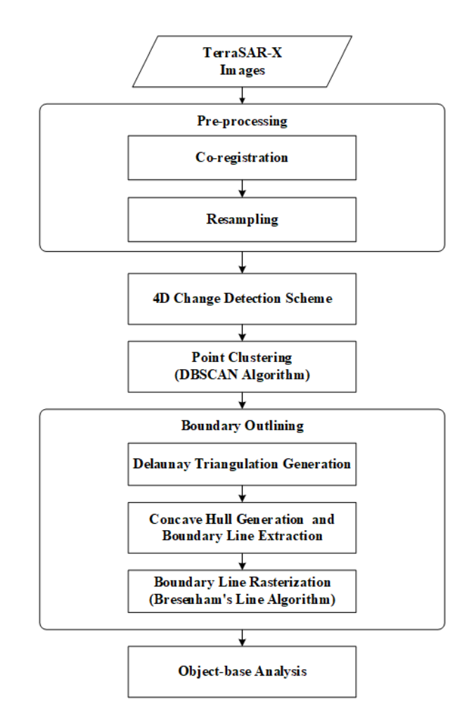
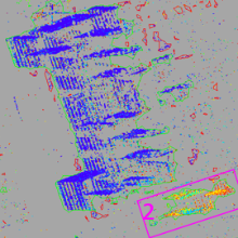
Figure 2 and 3 show the results of applying the proposed methodology on part of test data. The green line demarcates the boundary of the clustered points, and the color green signifies that they are emerging buildings.
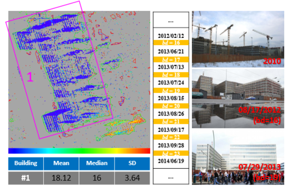
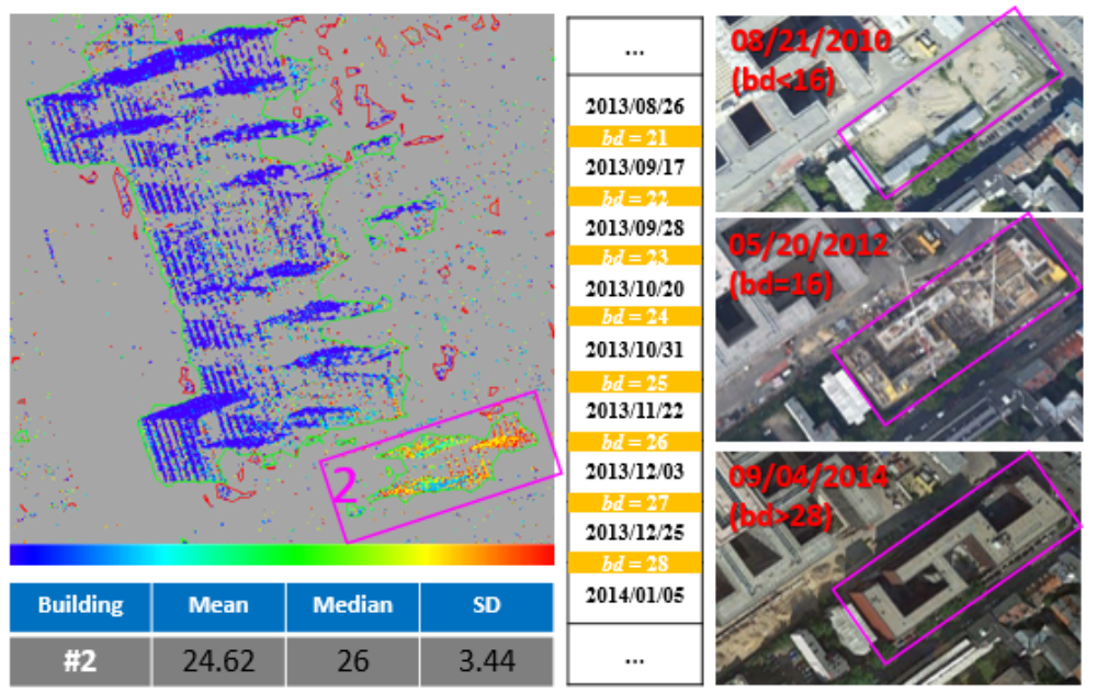
From the statistical results, we can estimate the change times and infer the construction velocity of each object. We can further explore the change process by applying a pixel-based analysis on the points within a clustered object.
Conclusions
The aim of this research is to develop an efficient way of monitoring change objects. The center of Berlin was chosen to investigate its feasibility and application for construction monitoring. Three patches are selected to describe in detail and compared with the ground truth for validation purposes. The case studies reveal that building demolition, erection and renovation can be distinctly recognized along with the change times for adding or removing substructures. Additionally, a point-based analysis targeting substructures can be conducted for a more detailed investigation if necessary. To summarize, our method is applicable as a means of effectively monitoring building construction with detailed and comprehensive spatiotemporal information.
Bibliography
[1] Gamba P (2013). “Human settlements: A global challenge for EO data processing and interpretation”. In: Proceedings of the IEEE 101.3, pp. 570 –581.
[2] Marin C, Bovolo F, and Bruzzone L (2015). “Building Change Detection in Multitemporal Very High Resolution SAR Images”. In: IEEE Transactions on Geoscience and Remote Sensing 53.5, pp. 2664 –2682.
[3] Yang CH, Kenduiywo BK, and Soergel U (2016). “Change Detection Based on Persistent Scatterer Interferometry - a New Method of Monitoring Building Changes”. In: ISPRS Annals of Photogrammetry, Remote Sensing and Spatial Information Sciences III-7, pp. 243–250.
Ansprechpartner

Uwe Sörgel
Prof. Dr.-Ing.Institutsleiter, Fachstudienberater